If you’re like… well, just about everyone, you probably use Google Maps to get from Point A to Point B and that’s it.
But this venerable route wrangler is more than just a navigation app. It’s got some not-so-obvious features that are helpful beyond finding your way around.
Here’s a look at five of my favorites.
Dude, where’s my car?
Am I willing to admit I’ve misplaced my car more than once in the past five years? I am not. Not here, at least.
But let’s say, hypothetically, that it might be helpful if there was a way to track it down every once in a while.
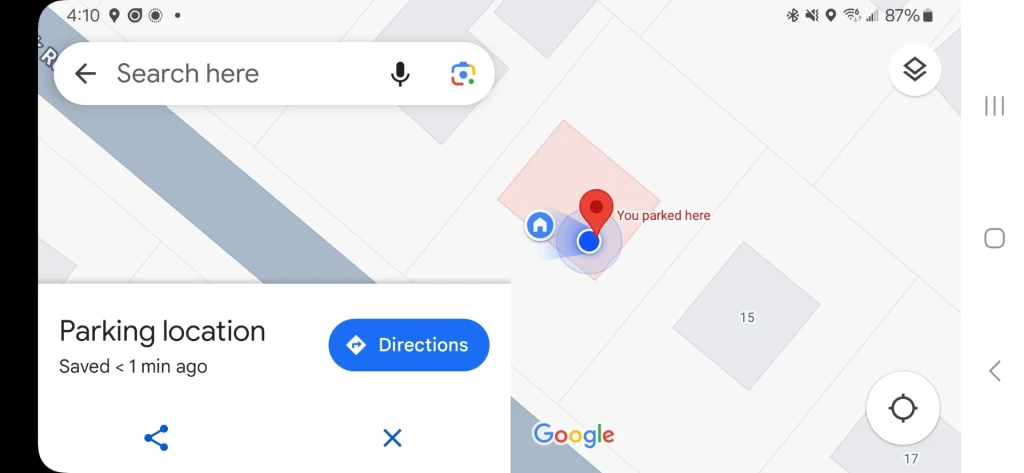
Thankfully, Google Maps turns your smartphone into a smart parking assistant. After you park, simply tap your blue location dot and select “Set as parking location” (iPhone) or “Save your parking” (Android) on the card that pops up.
You’ll then be able to search for your parking spot when you need to find your car by using the search function in the Maps app.
Break out a giant digital tape measure
Curious about the exact length of your morning run or the distance between two points? Google Maps has you covered.
Long-press your starting point on the map, tap the pop-up menu, and choose “Measure distance.”
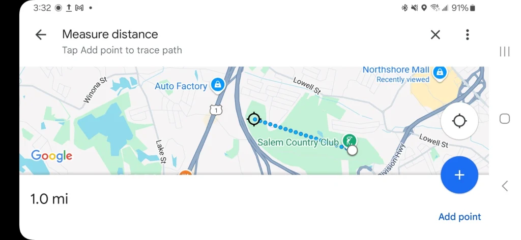
Then, drag to measure the distance as the crow flies between your two points of interest. You can also add additional points along your route by tapping “add point” in the measuring tool at the bottom of the screen.
This feature is great for hikers, runners, or anyone who needs precise distances in a pinch.
Make short work of malls, airports, and more
Forget the days of trying to find a “You Are Here” map while you’re lost in massive airports, shopping malls, or stadiums.
Google Maps transforms into an indoor navigation tool when you zoom into large buildings, complete with labels for shops, gates, restrooms, and other key locations.
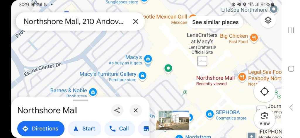
Depending on the building, you can often even swipe between floors with the level selector, navigating complex spaces like a regular.
Master multi-stop trips
Road warriors, this one’s for you.
Enter your first destination, then tap Directions. You can then tap the three-dot menu in the upper right and start adding additional stops.
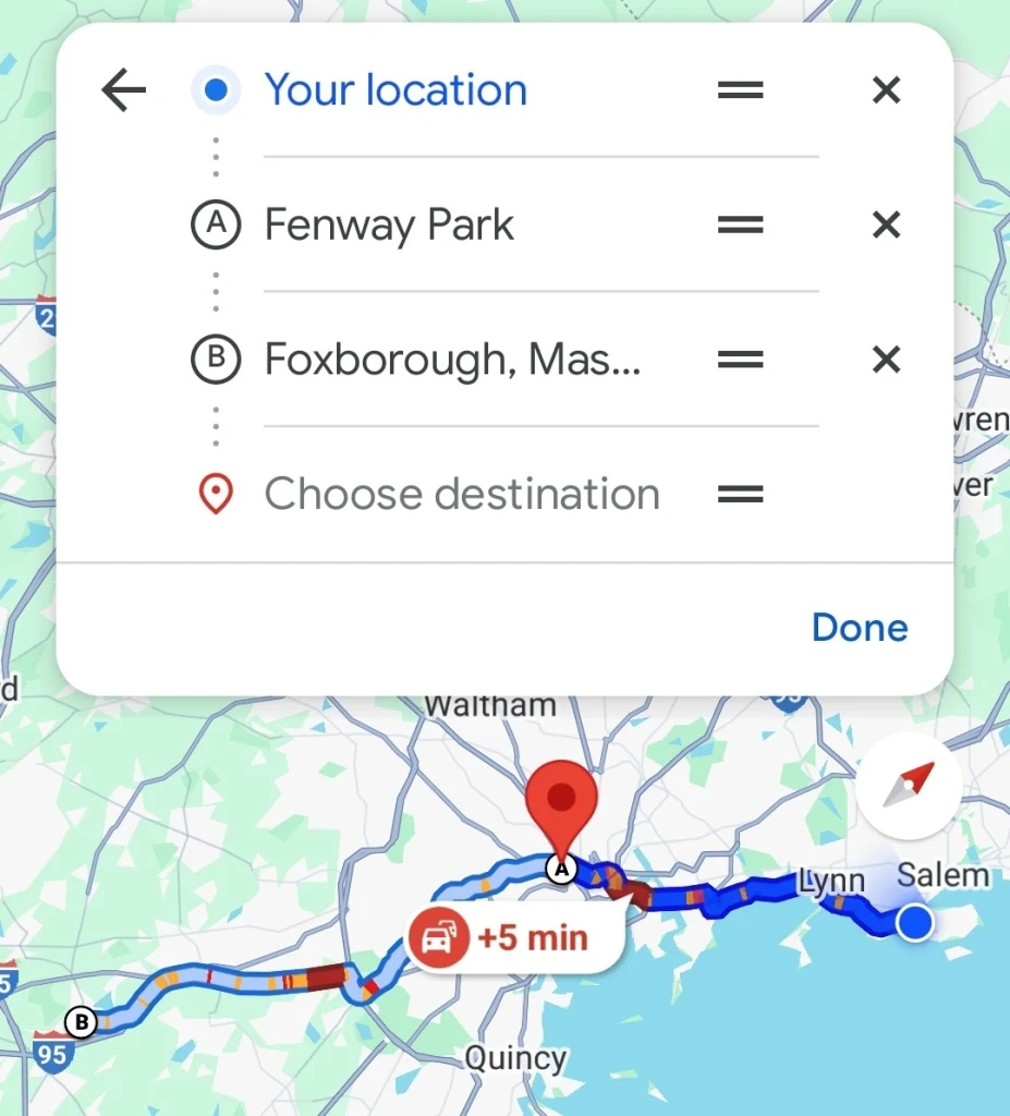
Repeat this process until your entire route is mapped out, reordering stops as you see fit by dragging them up and down the list you’ve compiled.
Street View time travel
“This place sure has changed.”
“Tell us more, Grandpa!”
“Tell you? Heck, I’ll show you!”
That’s me, one day in the distant future, telling super interesting stories to my very attentive grandchildren, who hang on my every fascinating word.
You, too, can unleash your inner historian with Google Maps’ time machine feature.
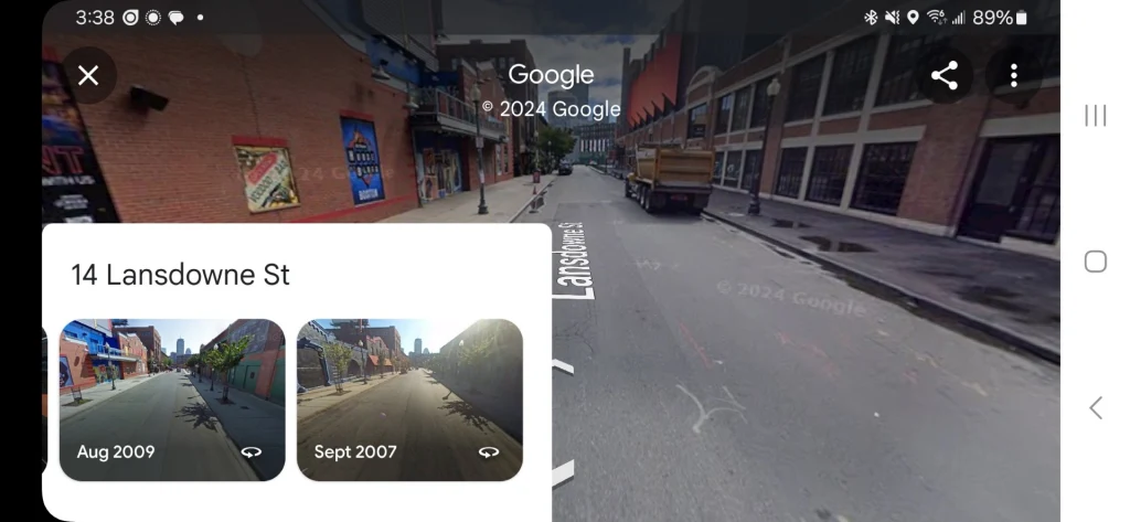
When in Street View mode, tap on a non-interactive part of the screen – not one of the arrows that move you around – and if there’s historical imagery available, you’ll get a “See more dates” link on the location’s card.
Tap it to explore past imagery. Watch neighborhoods transform, revisit memorable locations, or simply see how a place has changed over the years. If you’re lucky, you’ll be able to see as far back as 2007 when Google’s Street View fleet first rolled out.
Accedi per aggiungere un commento
Altri post in questo gruppo

Former employees of OpenAI are asking the top law enforcement officers in California and Delaware to s


Microsoft released its annual Work Trend Index report on Tuesday, which argued that 2025 is the year that companies stop simply experimenting with AI and start building it into key missions.

Artificial intelligence has rapidly started finding its place in the workplace, but this year will be remembered as the moment when companies pushed past simply experimenting with AI and started b

As the founder of World Central Kitchen, renowned chef and humanitarian José Andrés has truly mastered the art of leading through crisis. Andrés shares insights from his new book, Change the R

European Union watchdogs fined Apple and

